Skip to content

Slættaratindur Traditional Geocache

This cache has been archived.

peter-tvm: Unfortunately all good things tend to have an end. And now this cache has reached it end.

Hopefully an new cache will be placed here on The Faroe islands highest peak, so that there will be an incitement for cachers to continue to hike up here.

More
Hidden : 6/25/2013
Difficulty:
2.5 out of 5
Terrain:
3.5 out of 5

Size: Size:   small (small)

Join now to view geocache location details. It's free!

Watch

How Geocaching Works

Please note Use of geocaching.com services is subject to the terms and conditions in our disclaimer.

Geocache Description:

Slættaratindur is with an altitude of 880 meters the highest mountain in the entire Faroe islands.
Some sources claim that the altitude is 882 meters, but on 19 July 2012 Umhvørvisstovun, the Faroe Environment Agency, did an remeasure of the altitude and the result was 880 meters. The news release can be read here: Slættaratindur 880m.


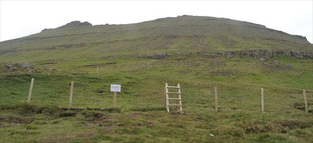
Leave your vehicle at the parking, and then ascend the hill following the fence up to the trailhead. From there the path is clearly visible all the way up to the summit.

The distance from the parking to the summit is almost 2 km, and it will take about 40-60 minutes to walk up there. Expect that the complete tour takes 3 hours, since you probably want to stay a while at the summit.
 

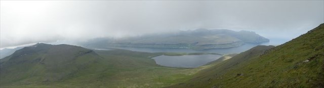
Up on the summit you will on an clear day have an extraordinary view over the surroundings.


The guardian of Slættaratindur.

If you are lucky, you can on the way up get an glimpse of Slættaratindurs guardian. The guardian is an very shy creature and very few people has ever seen it.

Additional Hints (Decrypt)

Gur pbagnvare vf uvqqra n srj zrgref haqre gur fhzzvg. Tb qbja gur fznyy tnc qverpgyl bire gur pbbeqvangrf, naq gura frnepu sbe na gevnathyne funcrq ubyr znqr ol na fgbar yrnavat gbjneqf gur pyvss.

Decryption Key

A|B|C|D|E|F|G|H|I|J|K|L|M
-------------------------
N|O|P|Q|R|S|T|U|V|W|X|Y|Z

(letter above equals below, and vice versa)